The City of Bogotá’s Journey to Adopting a New City Plan: Perspectives and Lessons Learned for Canadian Cities
Let’s forget about Toronto, Vancouver, Los Angeles, and New York for a moment and learn together about a city that you may or may not have heard of, but which I’m sure can teach us something, big or small: Bogotá. I went back to Bogotá after almost three years from my last visit, and it was quite an amazing experience. Everything seemed so strange, even though it was all part of my everyday life for twelve years before I moved to Canada. Honestly, I didn’t know what to tell friends and family when they asked “how are you finding Bogotá? Is it different or the same as when you left?”. I know they were looking for a common place to connect with me; perhaps we could complain about traffic, or talk about how lively and busy the city is compared to my new home, Edmonton. I had nothing to say; it felt like I had never left, but also like I had never lived there at all. I didn’t know what to say, so I observed. I paid more attention to Bogotá in the two weeks I visited with my family than in twelve years living there, and it was mind-blowing.
I’m not going to describe all I observed, because it led me to a deeper, more concerning thought. I asked myself repeatedly, why is it that planners in Canada are not looking at this stuff? I recalled that one of the first steps in the planning process is background research, but somehow we are obsessed with looking at “comparable cities” while closing our eyes to the great things that are happening elsewhere in the world. I understand the merits of looking at cities of a similar size and context to our own. Evidently, cities with similar problems can offer solutions that are more easily applicable in our own context. But why limit our knowledge of urban challenges to a narrow geography when there is so much insight to be gained from understanding how they unfold in radically divergent places? Chaotic cities in developing nations have a lot to offer us, and reflecting upon their history and challenges can greatly enrich our profession, despite contextual differences.
I called my friend Gabriel Millán, who works as an Urban Planner Technical Advisor for the Deputy Chief Planner at the City of Bogotá’s Planning Department, and serves as Internal Liaison and GIS Lead for the City Plan team. He agreed to an interview to discuss the city’s journey of adopting a new City Plan, including the importance of the new Plan, the details of the proposed growth model, and lessons that can be learned for Canadian cities, particularly Edmonton. My goal with this is to talk about some place different for once. Here’s our conversation:
Note: Writing in italics are notes added to explain context and are not the words of Gabriel Millán
What is the City Plan and why is the ongoing update to this plan important?
GM: The City Plan is a roadmap for Colombian cities (in Colombia, the equivalent of a City Plan/Official Plan/Municipal Development Plan is called Plan de Ordenamiento Territorial (POT), which translates to Territorial Arrangement Plan. For the purposes of this article, this instrument is referred to as City Plan). It is a long-term planning instrument that defines where and how development may unfold in a city. It encompasses the different structural components of a city, proposes a growth model that ties them together, and lays out development regulations to support this vision (Colombian cities don’t have zoning bylaws. Land uses and general development regulations are contained in the City Plan, and the local government can also adopt bylaws with more thorough regulations for specific areas in the city). A key requirement to ensure a coherent development process through the implementation of this instrument is continuity, but the changes in the political landscape that happen every four years because of the local elections make this challenging.
The horizon of a City Plan is supposed to be twelve years. In Bogotá, the first City Plan formulated under this legislation was adopted in the year 2000, with an amendment and a compilation made in 2003 and 2004 respectively. Since then, there have been two failed attempts at rewriting the Plan. This year (2021), current Mayor, Claudia Lopez, presented a new City Plan to Council. This is the third time a mayor has tried to adopt a new City Plan in twenty-one years. Council debated the Plan extensively but ran out of time to decide whether to adopt it. Lopez’s options going forward are to adopt the Plan by decree (a bylaw adopted by a Mayor alone when Council cannot reach a decision within a prescribed term), or go through the formulation process again until the Plan is satisfactory to the public and Council (since the interview was conducted, Mayor Claudia Lopez adopted the new City Plan by decree). Fortunately, she still has two years until the end of her term so there is still time to successfully adopt this Plan.
Could you expand on the previous attempts at updating the Plan?
GM: In 1998 the Colombian government passed Bill 388, creating multiple planning instruments to enable better urban planning at the municipal level, such as the City Plan. Bill 388 regulated the contents and approval process of the City Plan, and set the horizon of this instrument at three city administrative periods, which generally translates to twelve years. This means the Plan can only undergo what is called an ordinary revision every twelve years, allowing changes to all the components of the Plan, including structural ones. Otherwise, any changes made in between are called exceptional revisions and they cannot alter those structural components.
In 2000, Bogotá became one of the first cities in the country to formulate a City Plan under this legislation. This first attempt was relatively successful, but it had some gaps. In 2003, Antanas Mockus, then Mayor of Bogotá, proposed an exceptional revision to fill these gaps and solidify the growth model for the city.
In 2013, Gustavo Petro, then Mayor of Bogotá, proposed an exceptional revision to the Plan. His proposal was to build a more compact city through intensification and densification in the core. Though driven by a noble intention, his Plan omitted the need for adequate services to support such high densities and was highly criticized. Seeing as he wasn’t going to gather enough political support for his proposal, he adopted the Plan by decree. This didn’t pan out as he expected. His decree was challenged by multiple lawsuits and fell through before the end of his term.
Between 2016 and 2019, Enrique Peñalosa attempted a new ordinary revision to the Plan. Peñalosa’s idea for the city was completely opposite to that of Gustavo Petro, as he believed that Bogotá needed more land to accommodate future growth. His proposal was to enable large reserves of land at the fringe for urban development. The problem was that his growth model would have decimated the Thomas Van der Hammen Natural Reserve, the largest and most important environmental reserve in the city outside of the Eastern Hills. Due to the public backlash, the Plan was only formally presented to Council by the end of Peñalosa’s term. Council rejected the Plan, and the administration didn’t have enough time to come back with a new proposal.
So after almost twenty years since the first Plan, what is the biggest challenge facing Bogotá and how does the new City Plan address it?
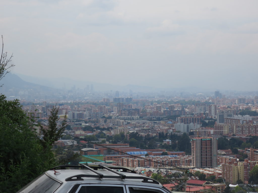
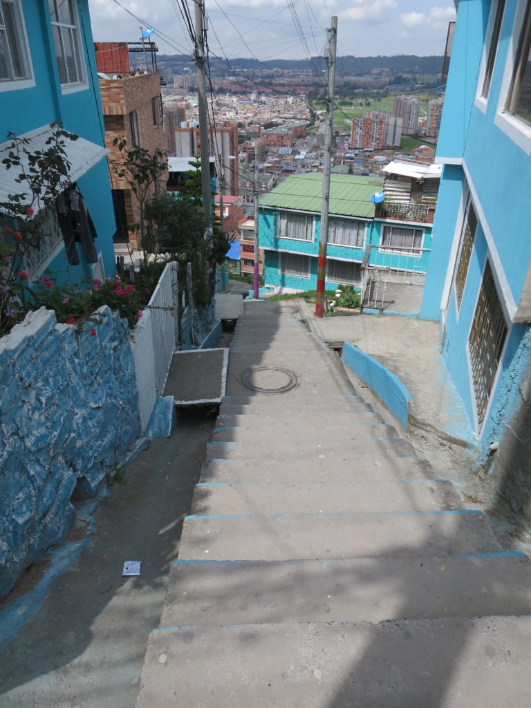
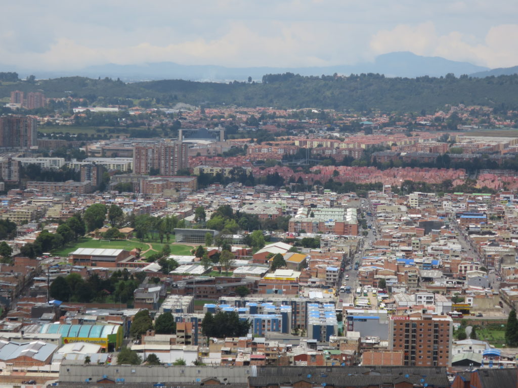
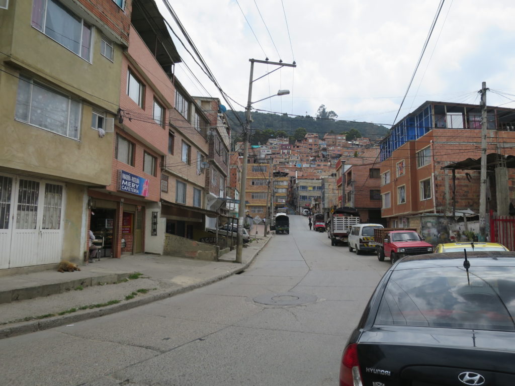
GM: With a vast geographic extent and large population size, development in Bogotá occurs in very diverse ways. Some areas in the Eastern Hills, for instance, are being developed both through informal settlements by the most disadvantaged and marginalized sectors of the population, and through high end real estate projects for the wealthiest. There is already a bylaw that protects the Eastern Hills as an Environmental Reserve by clearly outlining the existing informal settlements that can be safely integrated to the city and the ones that need immediate relocation due to landslide risk, and by prohibiting further urbanization in the Reserve. The City Plan builds on these efforts to protect the foundational environmental system of the city.
But this issue is not only environmental. The need for relocation of some of the Eastern Hills settlements adds to the ever growing pressure of population growth. The question of where to locate all these people is a pressing one. With little to nonexistent availability of developable land, Bogota does not have the capacity to foster these patterns of population growth. The City Plan identifies the most suitable areas for infill and intensification to maximize our urban space. But the challenge is not only to find the space but to stimulate the housing market and increase the number of units that are built every year. So, the City Plan also emphasizes the flexibility of the instrument and processes in place to develop and/or redevelop large areas of the city.
Regarding the housing market, social housing is the easiest to sell and therefore the type of housing that developers build the most in Bogotá. This is because in Colombia developers have a huge incentive as they get the sales taxes reimbursed when they build this type of housing. However, the existing instruments that enable new comprehensive development are inefficient, so development takes a long time. For instance, the concept plan proposed in a Plan Parcial (equivalent to Area Structure Plans and Area Redevelopment Plans) must be thoroughly evaluated, not only for its own merits but in regard to how well integrated it is to the rest of the city, and currently that is taking a prohibitive amount of time. Plus, if the Plan Parcial is for redevelopment, the engagement requirements are such that developers see it as a hindrance, so they opt for piecemeal development. This was a challenge that we considered in the City Plan.
What you say about social housing might come as a shock to planners in cities that struggle to build enough social housing to match the need. Would you care to elaborate?
GM: Yes, social housing is massively produced in Colombia, but there are many challenges. One of them is who is accessing it. The government regulates the market price of social housing so that it can be afforded by low-income individuals and families. There are benefits and subsidies for both the developers and the buyers, so it should work in theory, but the government doesn’t regulate the quality of social housing. For instance, there isn’t a minimum area requirement according to the household composition and size. So, while the families that need this type of housing have between three and five members, the products being offered are usually eighteen square-meter apartments with an open layout, be it bachelor suites or one-bedrooms, so clearly the size is not optimal for these families. Also, developers build in strategic locations with a high potential for valorization, so it appeals to young professionals, couples and people that want it as an investment opportunity.
And I should clarify that the government does have standards in place to determine who can access the subsidies for social housing, like a maximum income. However, the market itself is free, so developers can sell to anyone, whether they have a subsidy or are paying in any other way. That’s how people who technically don’t need social housing end up owning one or several units, while the families who would benefit the most have to settle in the outskirts of the city, generally in informal settlements, with all sorts of difficulties in accessing services.
How would you describe the urban form proposed in the new City Plan?
GM: Our proposal is largely focused on two basic systems. One of them is the environmental system, which is considerably strengthened compared to the previous City Plan. What we are seeking is the contiguity of key environmental elements that are currently fragmented, in order to protect their ecological value vis-à-vis climate change. One of the steps in the City Plan approval process is reaching an environmental consensus with the local environmental authorities. This time we’ve reached that consensus and got their approval way faster and easier than during previous attempts, and that is because our environmental focus is evident throughout the Plan. The second system is the integrating network of heritage resources, and not only material heritage but immaterial too. The City Plan is clearly identifying these landmarks and areas, and it is clarifying how to preserve it, and what and how development is to occur around them.
Another important principle that defines this Plan’s proposal is the fact that we are not designating any new lands for urban expansion. We are betting on infill and urban renewal, which is why we have identified several areas in the city where we can facilitate this through a confluence of modes of transportation, creating a high potential for densification and intensification. This is going to be particularly important along proposed light rail transit lines.
The social component of the plan is also key in defining urban form. Throughout this whole process of drafting a new City Plan, we have talked about the debt this city has with the population that has been marginalized and pushed outwards. Currently, we see Bogotá as two cities, one of them is the central and well-established inner city, and the other is at the periphery, which has been consistently ignored due to its complexity. We are proposing that the city be classified into two categories, deficit and non-deficit areas, so the City can better target public space, transportation, and servicing interventions. The goal is to bring deficit areas up to speed, and we have created mechanisms to promote spatial equity throughout the development processes, so that they receive the attention they need.
The City Plan also seeks to establish Bogotá as a city of proximity and care, meaning all the goods and services related to human care are easily accessible from anywhere in the city. Currently, these services are primarily located along the eastern boundary of the city and downtown, but we need to change this, especially for deficit areas. These goods and services also have a great potential to revitalize and generate economic activities within deficit areas. We need to think about the whole urban environment, not just housing. Building enough housing units is important, but what’s also important is where they are located. We want them to be built in high quality urban environments, so we need to create them.
What about implementation? What are the strategies and interventions that will be key to realize this vision?
GM: Structurally speaking, the light rail transit system is going to be critical. We are proposing two lines to connect the city with the region and five lines to connect the city internally from north to south and east to west, and to strategically complement the current mass transit system, TransMilenio (Bus Rapid Transit). As I said before, these new transportation corridors will present an opportunity for redevelopment with more suitable densities. It will also serve as a catalyst for economic activity throughout the city, and will help improve connectivity in deficit areas as we integrate this system with other transportation infrastructure, such as cable cars, to reduce the daily commute times of people living in the periphery.
The City Plan is also proposing a new planning unit, which will become the new political and administrative subdivision of the city, to facilitate the implementation process, among other benefits. At the core of this is what we call Local Planning Units (LPU), which will help us better understand the nuances of the urban fabric within each district so we can better plan and manage them. The ultimate goal with LPUs is to hone the local scale and create districts where people can live and access all the services they need within a short distance. We have started a characterization process for the support systems and services present in each LPU, and with help from the public we are identifying priority projects and interventions to transform these areas in a positive way.
Now let’s talk about climate change. What are the challenges that climate change has brought to Bogota and how does the new City Plan address them?
GM: In terms of climate change mitigation, there are a few strategies. We are looking at reducing emissions by reducing the distance people must travel to their places of work or to access goods and services, and that’s all part of the plan for the deficit areas and the LPUs. But the challenge is bigger than that. Bogotá is surrounded by dormitory communities where the cost of living is lower, primarily because land is much cheaper. A lot of people live in these communities and commute in and out of the city every day for work and education purposes. Though this has changed in some way during the Covid-19 crisis, it still represents a significant concern regarding transportation, CO2 emissions, and availability of urban services. Addressing this challenge will require regional cooperation.
Improving the city’s delivery of mass transit with the new light rail transit lines will also help create a more efficient and appealing city-wide transportation system to reduce the need to use private vehicles. We have also designed street profiles with a better distribution of space to prioritize pedestrians and bicycles, and we have designated special freight corridors to streamline and speed up cargo transportation, a major source of emissions. In fact, the new City Plan supports rail to complement cargo transportation so that there are fewer diesel vehicles on the streets, but this is going to require regional cooperation as well.
You mentioned Covid-19 has reduced the daily number of commutes in and out of Bogota, which is something we’re seeing globally. In what other ways has the Covid-19 crisis impacted the city and how has that reflected on the City Plan?
GM: The transition from in-person to virtual modalities has had a big impact on the real estate dynamics of the city. A lot of offices and shopping centres are now vacant. The City Plan that is currently in place has rigid regulations that limit the manoeuvring room to repurpose these empty buildings. The new Plan is much more flexible; it has regulations in place to protect residential areas, but it is responsive and allows the redesignation of uses to enable development, redevelopment, and transformative interventions in the city.
You have mentioned a few aspects of the new City Plan that are outside the box compared to what the city has had in the previous two decades. Is there any innovation in the new Plan that you feel particularly proud of?
GM: I am especially proud of the social and spatial justice lens of this new Plan, that is the new spatial distribution that is being proposed to create a more balanced and equitable city. The Plan will provide tools to create public space and amenities, social housing, and we have built in a lot of incentives for developers to be a part of the realization of this vision. We hope to reduce inequality as much as good urban planning can, but we know this needs a much more comprehensive effort with social policies. We are leaving a solid foundation for that.
Once the Plan is approved, what challenges do you foresee in the implementation phase?
GM: Development regulations are going to be the hardest to implement. The transition period takes months, and it requires a lot of openness, dialogue, and education efforts from the City to mitigate the effects of this transition and make sure people understand how to use and interpret the new Plan.
Another big task is the public engagement program for the characterization of the LPUs and identifying what’s most pressing and most important for residents. This is going to take two years, and then comes the integration of all this effort into cohesive and integrated action plans that respond both to the very local needs of the LPUs and to the bigger picture of the City Plan principles.
We built a monitoring and implementation system into the new Plan with solid indicators to provide a clear baseline and help us identify the areas where we are making progress, the areas where we are lagging and, most importantly, why. In line with the Open Government model of the City of Bogotá, the plan also has a governance, accountability and transparency strategy to show the public the progress we make in areas that are not as visible as infrastructure. Until now Bogotá didn’t have an organized framework to do this work. Implementing this is not going to be easy but it will make a significant difference, as it will show a much clearer direction for the future and provide hard data to justify what is working and worth keeping, and what needs to be tweaked.
As a professional in Urban Management and Development, what has been the most valuable lesson from your participation on this project?
GM: Given the responsibilities of my position, I had the opportunity to work across disciplines within the Planning Department, and with other Departments at the City. I was also involved in the presentations and negotiations with Council, and in the public engagement component of the formulation of this Plan. The holistic approach of my background allowed me to do this, and it was a great learning opportunity that I can leverage into my role during the implementation phase.
The formulation of a City Plan is not only technical but also very political. That political aspect is evident in the fact that the Council could not come to a decision on the Plan within the established timeframe. We prepared multiple presentations for Council, and technically speaking they were positive, but politically there were too many procedures, and higher instances and interests that hindered that technical foundation of the Plan. The challenge is always going to be achieving a consensus with all the parties involved. It is critical that we understand the political component of this process very well so all the technical work and the effort that the public has put into this doesn’t go to waste. I had the opportunity to be a part of this and it gave me invaluable lessons for the future.
On a closing note, I want to get your perspective on Canadian cities since you spent some time in Edmonton doing planning-related research. Considering the significant differences between the planning context in Canada and Colombia, what lessons can a city like Edmonton learn from Bogotá’s new City Plan?
GM: That’s interesting because Edmonton and Bogotá have similar areas, but Edmonton has about an eighth of the official population count of Bogotá. We have over eight million people living here and very little developable land because of geographical and political-administrative boundaries. We are being forced to think outside the box and find imaginative solutions for this very pressing issue, but there are a lot of constraints for us. Edmonton is not there yet. I don’t doubt that population growth creates its own set of challenges there, but the magnitude of the issue and the constraints that Bogota is experiencing are not the same. Edmonton must take advantage of that manoeuvring room it has for planning a better future, and study the experiences of other cities to learn how to use the available land more efficiently so it never has to be in the position where Bogotá is today.
Bogotá is also way behind in mass transportation because the plans to build the light rail transit system have been left on paper for way too long. Edmonton was ahead of the game when it built the LRT and that’s a huge structural advantage to grow and diversify the city.
- Nathalia Schwind