Mount Kerkeslin and the Athabasca River

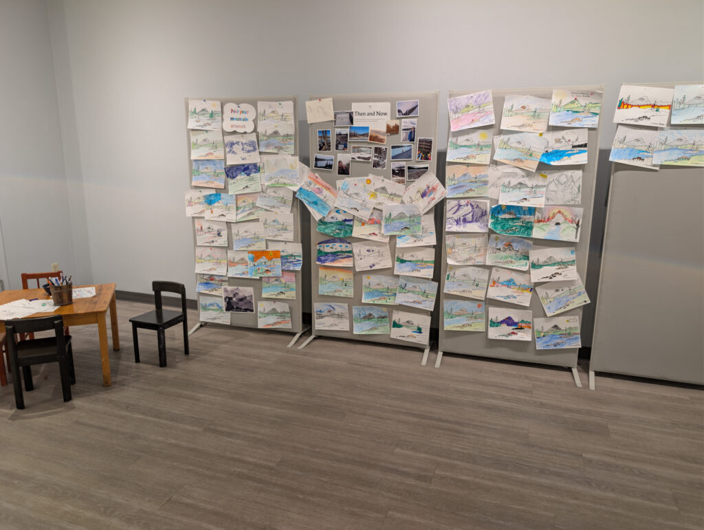
Do you have personal photos of old and recent visits? Bring your new and old family photos taken around Jasper to pin up at the exhibition or submit them at the Museum for a display alongside the exhibition.
Interview on CBC Daybreak Alberta with Paul Karchut – https://www.cbc.ca/listen/live-radio/1-95-daybreak-alberta/clip/16219265-new-exhibition-display-jasper-yellowhead-museum-archives
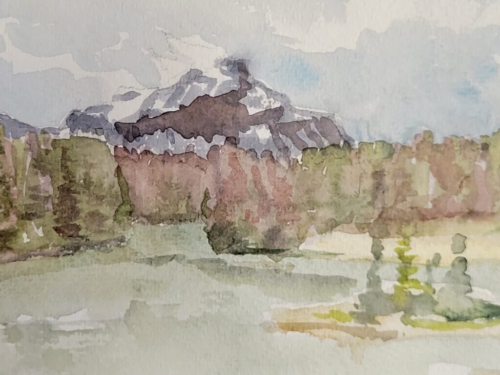
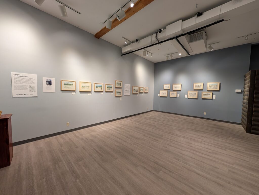
I returned to the same spot over twenty years, making sketches of Mount Kerkeslin in the Canadian Rockies just south of Jasper from a beach along the Athabasca River. They show the continuity, evolution and resilience of the ecosystems of the area and are presented as a tribute to the community and the Park environment.
These paintings continue a tradition of “plein air” sketching in the Rockies and in Canadian landscape art generally. Done at one site on the Athabasca River, the paintings witness the changing composition and colour of the forests, the river, seasons and the rising tree line on Mt. Kerkeslin from 2005 to 2025. The paintings unintentionally reflect what drew my attention that day. They show the light and colours, the limits and conditions on site when they are made, sometimes being altered or damaged by rain and snow.
This iconic national site intersects with multiple traumas including the construction of Jasper National Park infrastructure by wartime internees and Indigenous displacement from Jasper National Park. Even what is absent is relevant. More clearly visible are environmental traumas.
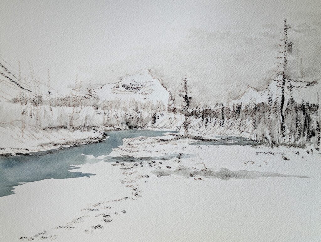
Intended as personal sketches, the first paintings show how the view looked from 2005 to 2012. The images of the 2012-23 cover before, during and after the Mountain Pine Beetle infestation as the forests turned shades of purple, brown, grey before bright greens of new growth appeared. The most recent sketches show the impact of the Jasper Wildfire. They are done with the charcoal of the burnt spruce on site.
Mountain Pine Beetle 2014-20
The Mountain Pine Beetle affected Jasper National Park primarily from 2014 to 2020. The beetles are indigenous to the west coast and lodgepole pines common in British Columbia. However, their population increased due to warm winters when they were able to overwinter just below the bark of trees. Blown over the Rockies by summer windstorms, the Mountain Pine Beetles expanded their diet to Jack Pines to infest more that 2.4 million hectares (5.93 million acres) of forest in Alberta by 2019, killing nearly all of the pine trees in affected areas including Jasper National Park.
The paintings from the late twenty-‘teens illustrate the impact of the beetles. The colour of trees that were attacked changed to a lighter green, while the needles of those that were infested changed to a purplish-red, becoming grey over time before the bright greens of new growth appeared.
Jasper Wildfire 2024
For millennia, forest fires were a recurrent feature of the mountain landscape. Historical photographs reflect this. They show the patchiness of tree cover in the mountain valleys. Windy, warmer and dryer summers dried out the forests of the National Park. While there is debate about whether or not the dead trees worsened the fire risk, dried out forest floor vegetation, hot dry weather and wind spread the fire once started. The 2024 Wildfire spread rapidly in Jasper National Park.
The black and brown in recent paintings use the charcoal twigs of trees burnt on site in the 2024 Wildfire.
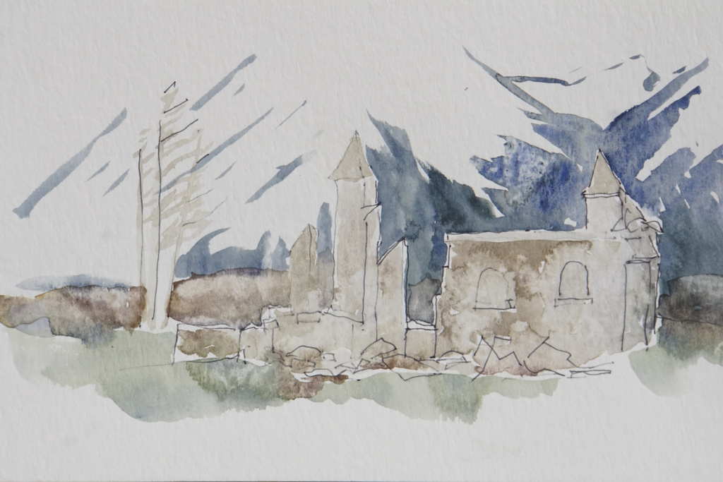
Three additional sketches after the 2024 fire show parts of the third of Jasper that was burnt, including the Anglican church, surrounded by omnipresent blue temporary fencing.
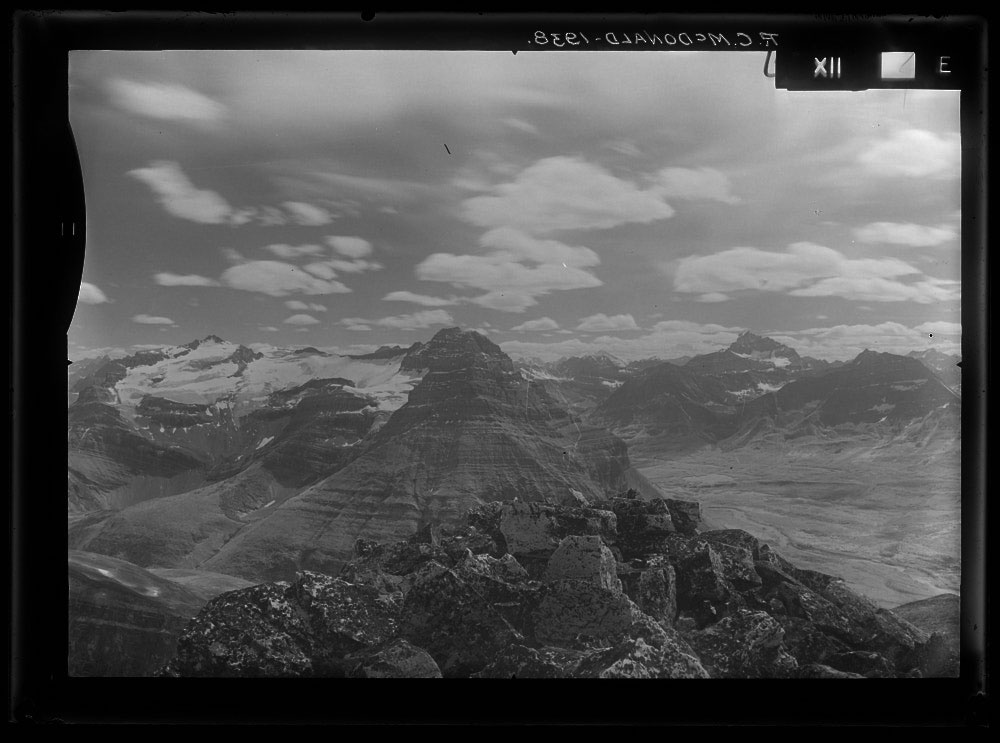
Survey Photographs
During 1915, M.P. Bridgland and later R.C. McDonald’s 1939 survey mapped Jasper Park on behalf of the Dominion Land Survey. Photographs were rigorously taken from high points and peaks, or “Stations.” Locating, leveling the camera and measuring on the images from their centre and horizontal “horizon line” allowed maps to be created from the photos that plotted railways, roads and boundary lines as well as elevations of peaks and valleys. They complement the passage of time and landscape change recorded in the paintings and sketches of the exhibition.
Thanks
This exhibition has been created thanks to a partnership of the University of Alberta HM Tory Chair, Jasper Yellowhead Historical Society Museum and Archives, Kule Institute for Advanced Studies, Jasper National Park, Parks Canada, National Archives Canada, Natural Resources Canada, Tourism Jasper, Eric Higgs and Katelyn Fryer at The Mountain Legacy Project University of Victoria, the c ommunities of Jasper and Hinton and the encouragement of residents, family, students and friends. Thanks to Heather Legacy, Karen Byers, Lily Hasinoff, Suraiya Farzana, Bohdana Dutka and Sophie Shields.
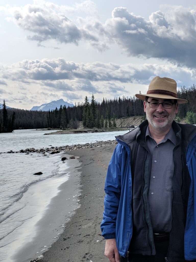
Rob Shields sketches and paints in watercolour. Trained in architecture, he researches images of places and landscape and our sense of social and cultural space. He holds a Henry Marshall Tory Research Chair at University of Alberta.